


- This event has passed.
Lake Tahoe Ride
October 11, 2023 @ 9:30 am - October 15, 2023 @ 3:30 pm
- Road Captain: Phil ‘Rain Man’ Rietz
- Departure Briefing: 9:30 am
- Departure Time: 9:45 am
- Departure Point: Chevron Station on Santa Maria Way and Bradley
- Secondary Departure Point: McChevron (McDonalds/Chevron) on Highway 46 west and Ramada Drive
CE – THIS IS A CLOSED RIDE TO THE PUBLIC. MEMBERS MAY BRING TWO GUESTS WITH THEM.
PLEASE ARRIVE 20 – 30 MINUTES PRIOR TO THE PRE-RIDE BRIEFING! (This will allow you time to visit other riders, use the restroom, fuel up, get a cup of coffee, etc.)
PLEASE BRING YOUR SM HOG MEMBERSHIP CARD FOR CURRENT STATUS!
Ride Rating: Moderate
to Complex
As in the past with my multi-day overnight rides I will hand out a ride plan for each day of the ride.
Day 1 – Santa Maria to Manteca
Destination / termination point for Day 1 will be the Best Western in Manteca
Depart Santa Maria from the Chevron Station on Santa Maria Way and Bradley and travel Highway 101 north to Highway 46 west and the McChevron station (McDonald’s / Chevron) (61.6 miles). Pick up north county riders, conduct pre-ride briefing for the riders from this stop. After we take on fuel and take a break, we will head north on Highway 101 to Highway 46 east. We will travel east on Highway 46 to the Highway 41 split, to Highway 33 and to Avenal where we will head east on Highway 269 to Highway 5 where we will head north to the Highway 198 exit, turn right, and stop at the Shell station for fuel and a break (78.6 miles). We will also eat lunch here at the Harris Ranch Quick BBQ. After lunch, we will continue north on Highway 5 to Exit 391 / Highway 165 and head north (57.9 miles). Coming into Los Banos we will turn left on Highway 33 / 152 and travel a short distance to the Chevron Station for short break (67 miles from Harris Ranch) to get rid of lunch liquids and top off the tanks. We will come out of the Chevron at the traffic light out of the parking lot and turn left. We will stay in the left lane and then turn left back onto Highway 165 and head north. We will pass through Stevinson, Irwin, and Hilmar on our way towards Turlock.
Just as we pass under Highway 99, we will get on Highway 99 north and travel 60 miles to our destination. We will travel through Modesto and on to Manteca taking exit 242 / E. Yosemite Ave (30.2 miles). and make a left, travel under the Highway 99 overpass and our destination will be on the right, Best Western Plus Executive Inn & Suites. Total Mileage Day 1: 267 miles
Best Western Plus Executive Inn Suites
1415 E Yosemite Avenue, Manteca, California 95336-5005
These rates are at the AAA / AARP / Senior Rate which is basically the same rate as the ‘Harley Rate‘
I do not have rooms blocked but I have made my reservations.
1 King Bed – $113.05 + taxes
2 Queen Beds – $122.55 + taxes
You may also use Best Western Points if you choose to do so
Restaurants within walking distance for dinner: The Black Bear Diner, Chick-fil-A, La Estrella Tacos & Seafood, Raising Cane’s Chicken Fingers, (these are across the road) In-N-Out Burger, Chipotle Mexican Grill, Panda Express, Chuck’s Place, Carl’s Jr, and Ono Hawaiian BBQ
Day 2 – Manteca to S. Lake Tahoe
Destination / termination point for Day 2 will be S. Lake Tahoe
After breakfast and we are all packed up we will fuel up next door at the Shell Station. When we are ready to go, we will get on Highway 99 north and head to exit 255 / CA-88 (14.0 miles) and then head east on Highway 88 traveling through Lockeford, and after passing through Clements, we will turn left and stay on Highway 88 to the 88 / 12 junction. At the Highway 88 / Highway 104 junction we will turn left onto Highway 104 that will take us towards Sutter Hill and after 1.6 miles we will make a stop to top off tanks and take a short break at the Sutter Hill Shell Station just after crossing Highway 49. After our stop we will head north from here on Highway 49. When we come to the Highway 49 / Highway 16 junction just past Drytown we will turn right and stay on Highway 49 and pass through Plymouth, and Enterprise. When we come into El Dorado we will turn right and stay on Highway 49 (25.3 miles). After a short distance we will turn left onto Missouri Flat Road. This will take us to Highway 50 after 1.7 miles.
As we head east on Highway 50 out of the Placerville area we will travel through Smithflat, Camino, Cedar Grove, Fresh Pond, Pacific, White Hall, Strawberry, and Twin Bridges. After passing Phillips we will gain a little elevation and pass over Echo Pass (7382 feet) and we will be hugging the mountain as we get our first glimpse of Lake Tahoe. Don’t get wrapped up in the scenery as we will encounter several twisties as we descend into Meyers. At the roundabout in Meyers, we will continue straight ahead into Meyers on Highway 50 and as we come into Tahoe Valley we will continue straight and onto Highway 89 for a short distance to Sonny’s BBQ Shack Bar and Grill where we will stop for lunch (62 miles).
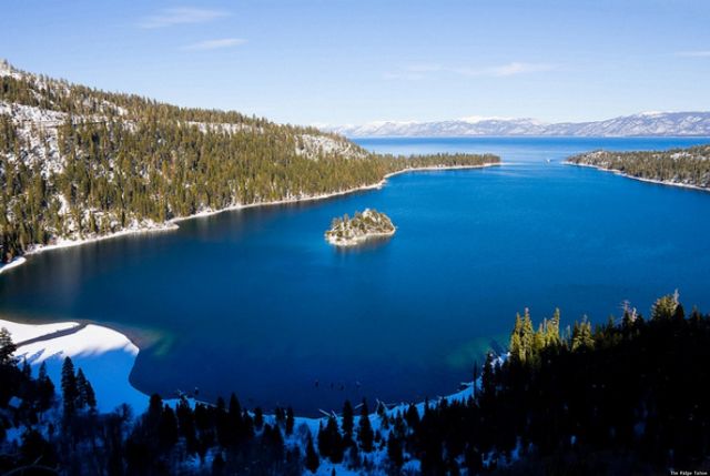
After lunch we will continue on Highway 89 and travel through Camp Richardson and around the west side of Lake Tahoe. We will make a stop at the turnout for Emerald Bay which will offer some great photos. From here we will get back on Highway 89 and travel through Meeks Bay, Tahoma, Homewood, Tahoe Pines, Idlewild and into Tahoe City. We will continue straight at the roundabout to the traffic light where we will turn left and stop at the Shell Station or the Chevron Station just past the Shell Station to fill up and take a short break (26.7 miles).
From the Shell or Chevron Station we will continue on Highway 89 at the roundabout and head towards Truckee. Coming into Truckee we will continue straight at the first roundabout, travel under Highway 80 to the second roundabout where we will take a left and enter the on ramp to Highway 80 west. This will only be for a short distance as we will take the first exit, Exit 184 and then take a left onto Donner Pass Road. This till take us around Donner Lake and we will make our way up to the Donner Lake Overlook just before the Donner Summit Bridge. This will offer up some great views of the valley and Donner Lake looking towards Reno (21.1 miles).
After a short time at the Overlook we will backtrack on Donner Pass Road and after passing by Donner Lake we will turn left onto Highway 80 east and travel to Exit 188B / Highway267. We will take Highway 267 south to Kings beach where we will turn left onto Highway 28. We will travel around the east side of Lake Tahoe traveling through Crystal Bay and Incline village and we will continue going straight at each one of the roundabouts we encounter as we head to the junction of Highway 50 (29.5 miles). Highway 50 continues around the east side of Lake Tahoe, and we will travel through Lincoln Park, Lakeridge, Skyland, Zephyr Cove, and Round Hill Village and on into S. Lake Tahoe and our destination for the day (12.1 miles). We will check in and get settled in before we gather and make plans for dinner, or you can choose to go on your own. We will fuel up the next morning for our Day 3 activities that will take us to Carson City.
Total mileage for Day 2: 242 miles
Hotel information
To stay in a dump or not stay in a dump. That is the question, well one of them. Access to food is another. I looked at the Casino’s and there is not much difference when you factor in paying for parking each night along with the hotel costs. I also looked at one of my favorite places in Lakeland Village Resort at Heavenly but they now want deposits up front and are less than flexible with their cancellations. So, we will try something different this time and see how it goes.
Hilton Vacation Club Lake Tahoe
901 Sky Run Blvd.
530.541.6122
Rates vary depending on if you are a Hilton Honors Member or not and if you join it may save you a few bucks plus you will start adding up points.
Studio Queen (rate does not include fees or taxes)
Flexible Rate – $149
Semi-Flexible Rate – $143
Non-refundable Rate – $126
Studio 2 Queen Beds with Kitchenette (rate does not include fees or taxes)
Flexible Rate – $159
Semi-Flexible Rate – $152
Non-refundable Rate – $135
You cost for these with all the fees and taxes will run from $396.41 to $418.30
Day 3 – S. Lake Tahoe to Carson City
After breakfast we are going to be heading to Carson City today. We will first head across the parking lot from the hotel to the Chevron Station. From here we will get on Highway 50 and travel east for 11.8 miles and we will use the left 2 lanes to turn left onto N Highway 395 / S Carson Street. At the roundabout we will continue straight on S Carson Street. We will turn left on W Robinson Street on the south side of the Nevada State Museum and United States Mint and then make an immediate right on N Curry Street where we will park in the public parking lot. We will then take in some great history at this museum. Admission is $10 and there are multiple levels in this museum including the U.S. Mint.
After our time at the Museum, we will gear back up and turn right onto W. Washington Street and then left onto N Carson Street and we will travel 1.1 miles to Wendy’s for a bite to eat for lunch. After lunch we will continue north on N Carson Street and make a right onto W College Parkway traveling under the Highway 580 overpass and then make an immediate right onto Research Way. This will take us to Battle Born Harley-Davidson to check things out.
After we finish up at Battle Born Harley-Davidson and get a group picture, we will travel back on Research Way to W College Parkway, and we will head south on Highway 580 south and pick up Highway 50 to our hotel. Total mileage for Day 3: 57.6 miles
Our return to the hotel will be the destination / termination point for Day 3
Day 4 – S. Lake Tahoe to Oakdale
Destination / termination point for Day 4 will be the Best Western on Oakdale
After breakfast and we are all packed up and ready to go we will head south through S Lake Tahoe, and we will stop at the Chevron Station located off Sky Run Boulevard. From here we will continue travel on Highway 50 and at the roundabout in Meyers we will pick up Highway 89 and head up and over Luther Pass (7740 feet) to Picketts Junction (Highway 89 / 88 junction).
We will turn right at Picketts Junction onto Highway 88 and at Alpine Village we will turn right onto Highway 88. We will head west over Carson Pass (8652 feet) and travel past Caples Lake, Kirkwood, Kit Carson and Silver Lake, Tragedy Spring, and Barton (71.7 miles). We will turn left on Silver Drive and make a pit stop to use the facilities and stretch for a short while at the 76 / Pioneer Trading Post. You can fuel if you would like but we will only be about 30 minutes out from Jackson where we will be making a scheduled fuel stop. After our break we will continue on Highway 88 west and travel through Pioneer, Pine Grove and Bonnefoy before coming into Jackson. We will turn right at the Highway 88 / Highway 49 junction and head to the Chevron Station on the right. After fueling up we will head back south a short distance to Mel’s Diner where we will grab a bite to eat.
After a bite to eat we will gear up and head south on Highway 49 passing through Mokelumne Hill, San Andreas, Fourth Crossing and Angels Camp. We will continue south passing over New Melones Lake and through Tuttletown (8.7 miles from Angels Camp). Just past Tuttletown (1.1 miles) we will turn right onto Rawhide Road and on into Jamestown. We’ll see how our time is and if time permits, we will go to Railtown. At the light we will turn left and travel .3 miles to 5th Avenue where we will turn right and make a stop at the Railtown 1897 State Historic Park. It has been several years since I have taken the Chapter to this location. Admission is $5. If you want to ride the Excursion Train Ride that will be an additional $15. This place is packed with a lot of history, and it has been a popular Hollywood location since 1919 with Railtown and its historic railroad cars appearing in over 200 films, television productions, and commercials. The Virginian, High Noon, Clint Eastwood’s Unforgiven, Back to the Future Part III, Death Valley Days with Ronald Reagan and Petticoat Junction have been filmed at Railtown.
https://www.parks.ca.gov/?page_id=491
After our visit here we will leave and get onto 9th Street, right on Seco Street, left on Donovan Street, and a left on Main Street to pick up Highway 49 / Highway 108 and head west to Oakdale. We will see a change in the terrain as we head west and get out of the Sierra Mountains and just past the Rodeo Grounds, we will stop at the 76 Station on our right. This way we will be ready to go the next morning as we head home. From here we will head a couple blocks to the Best Western Plus Rama Inn and Suites which is also on the right. Total mileage for Day 4: 165 miles
Best Western Plus Rama Inn & Suites
1450 E F Street, Oakdale, California 95361-9228
These rates are at the AAA / AARP / Senior Rate which is basically the same rate as the ‘Harley Rate‘
I do not have rooms blocked but I have made my reservations.
1 King Bed – $145.34 + taxes
2 Queen Beds – $147.24 + taxes
You may also use Best Western Points if you choose to do so
Restaurants within walking distance for dinner: Javi’s Mexican Restaurant, Fine Mexican Food & Bar, (to the east of the hotel) Wendy’s, A&W Restaurant, El Agave (across the road) Denny’s, Mountain Mike’s Pizza, and Bamboo Garden
Day 5 – Oakdale to Santa Maria
Destination / termination point for Day 5 will be our return to the Santa Maria area
After breakfast and we are all packed up and ready to go, we will head west on Highway 108 for a few blocks until we turn left on S Yosemite Avenue. This will change to Albers Road and Geer Road as we head south. We will travel 16.1 miles and then turn right onto E. Keyes Road and head to Highway 99 (3.3 miles). We will head south on Highway 99 to Turlock and take Exit 211 for Lander Avenue (6.2 miles) and head south to Los Banos (29.4 miles) on Highway 165.
We will continue south on Highway 165 for 57.1 miles until we come to Highway 5. We will head south on Highway 5 for 58.1 miles to the Highway 198 exit where we will stop at Harris Ranch. We will fuel up here at the Shell Station and if everyone would like we can grab a bite to eat at the Harris Ranch Express BBQ or travel to the other side of Highway 5 to either Taco Bell, McDonalds, or Carl’s Jr. I am pretty flexible on this one.
We will continue south on Highway 5 for 21.3 miles and take Exit 319 / CA 269 and travel through Avenal to Highway 33. We will turn left onto Highway 33 and travel south to Highway 41 where we will turn right. We will continue on Highway 41 to Highway 46 and make our way back to Paso Robles and pick up Highway 101 south. We will exit onto Highway 46 west and make our final stop at the McChevron (McDonalds / Chevron) to say our final goodbyes, take a short break and fuel up if need be. From here we will head south on Highway 101 back to the Santa Maria area (54.2 miles) where our ride will be terminated.
Total mileage for Day 5: 256 miles
If you have any questions please contact me at PhilipRietz@comcast.net or call me on my cell at 805-757-9202 and leave a message. I will get back to you.
Phil ‘Rain Man’ Rietz